


Google released a couple of amazing Google Maps features in the past few weeks alone, including AR navigation support that rolled out to Android and iPhone, as well as asmarter way to plan your commute. And Google isn’t done fine-tuning its navigation app, as the company has finally brought to mobile the one feature that was still missing in action.

© Provided by Penske Media Corporation
google-maps-street-view-layer-android
Available only on Android for the time being, which is the natural home of Google Maps, of course, is a Street View layer. Street View is one of the best features of Google Maps on desktop, allowing you to visualize the places you’re traveling to for the first time. And you can quickly move between Street View and regular Maps view on the web version of the app, something that wasn’t exactly possible on the mobile app.
A standalone Street View app is also available, but it’s a lot more convenient to have it all into a single app.
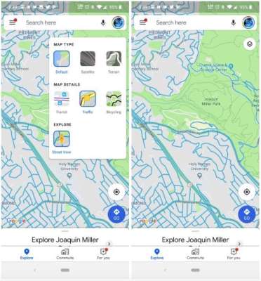
As seen in the screenshots above, via Android Police, the Street View layer is clearly visible, and it’s very easy to switch back and forth between the default and Street View version of the map.
Press the layer, and the map that’s in view will immediately highlight in blue all the roads and areas where Google’s cameras have been used to take 360-degree snaps. It’s just like the desktop experience, but you’ll have to tap on the location that you want to inspect rather than dragging anything on the screen.

 © Provided by Penske Media Corporation
Google Maps iPhone Sign
The feature has started rolling out on Android, and it’ll probably find its way to iPhone in the future.